
|
Chongqing Gold Mechanical & Electrical Equipment Company
|


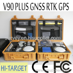
220 Channels Geodetic Survey RTK GPS for Coordinates Measuring
| Price: | 0.1 USD |
| Payment Terms: | T/T,L/C,WU |
| Special Groups: |
V60 GPS (10)
|
| Place of Origin: | Chongqing, China (Mainland) |
|
|
|
| Add to My Favorites | |
| HiSupplier Escrow |
Product Detail
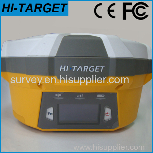
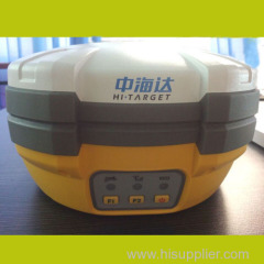
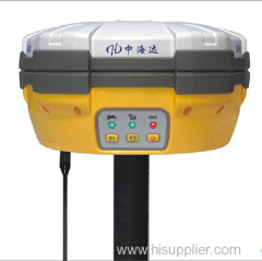
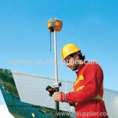
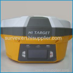
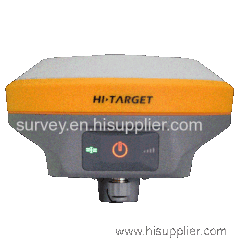
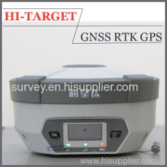
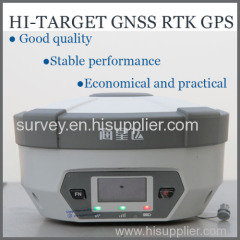
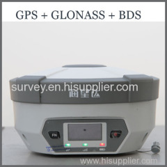
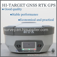
HI-TARGET V60 GNSS RTK GPS is widely used in engineering construction, land and forest measuring and management.
It's practical and reliable.
220 Channels Geodetic Survey RTK GPS for Coordinates Measuring
The V60 is a more compact-design and higher-performance GNSS RTK system, besides its rugged design to resist impact and vibration.
The V60 has industrial OLED display screen on its front control panel to show all information and status of the work. With the smart speaker inside the receiver, the DIY guiding voice can be customized in any language, even dialect!
1GB internal storage plus 8GB Micro SD card memory is standard, the V60 supports up to 32GB extension of memory.
The V60 is fully compatible with other GNSS RTK receivers from the world market. The static data can be saved directly in RINEX format.
Technical Parameters of the V60 Geodetic Survey RTK GPS:
MEASUREMENTS
• 220 Channels
• Advanced Pacific Crest Maxwell 6 Custom Survey GNSS Technology
• High precision multiple correlator for GNSS pseudo range measurements
• Unfiltered, unsmoothed pseudo range measurements data for low noise, low multipath error, low time domain correlation and high dynamic response
• Very low noise GNSS carrier phase measurements with <1 mm precision in a 1 Hz bandwidth
• Signal-to-Noise ratios reported in dB-Hz
• Proven Pacific Crest low elevation tracking technology
Satellite signals tracked simultaneously
GPS: Simultaneous L1C/A, L2C, L2E, L5
GLONASS: Simultaneous L1C/A, L1P, L2C/A (GLONASS M only), L2P
SBAS: Simultaneous L1 C/A, L5
Galileo: Simultaneous L1 BOC, E5A, E5B, E5AltBOC
BDS/Compass: B1, B2
QZSS: L1 C/A, L1 SAIF, L2C, L5
Positioning Performance of the Geodetic Survey RTK GPS:
Static and Fast Static GNSS surveying
Horizontal: 2.5mm+0.5ppm RMS
Vertical: 5mm+0.5ppm RMS
Post Processing Kinematic
(PPK / Stop & Go) GNSS surveying
Horizontal: 25px+1ppm RMS
Vertical: 62.5px+1ppm RMS
Initialization time: typically 10 minutes for base while 5 minutes for rover
Initialization reliability: typically > 99.9%
Real time Kinematic (RTK) surveying
Horizontal: 8mm+1ppm RMS
Vertical: 15mm+1ppm RMS
Initialization time: typically < 8 seconds
Initialization reliability: typically > 99.9%
Code Differential GNSS positioning
Horizontal: 625px+1ppm RMS
Vertical: 1250px+1ppm RMS
SBAS: 0.50m Horizontal, 0.85m Vertical
Hardware of the RTK GPS:
Physical
Dimensions (W x H): 18.20 x 9.80 (7.17 in x 3.86 in)
Weight: 1.25kg (2.76lb) without internal battery
Operating temperature: -45℃ to +65℃ (-49℉ to +149℉)
Storage temperature: -55℃ to +85℃ (-67℉ to +185℉)
Humidity: 100%, considering
Water/dustproof: IP67 dustproof, protected from temporary immersion to depth of 1m (3.28ft).
Shock and Vibration: Designed to survive a 3m (9.84ft) natural fall onto concrete.
Electrical
Power 6V to 28V DC external power input
Power consumption ≤3.5W
Automatic Switching between internal power and external power
Rechargeable, removable 7.4V, 5000mAh Lithium-Ion battery in internal battery compartment
Internal battery life
Static 13 - 15 hours
RTK Rover (UHF/GPRS/3G) 10 - 12 hours
RTK Base 8 - 10 hours
I/O interface
1 x Bluetooth
1 x standard USB2.0 port
1 x TNC UHF connector
2 x RS232 serial port
2 x DC power input (8-pin & 5-pin)
1 x Micro SD card port
Communication & Storage
3G Communication
Fully integrated, fully sealed internal 3G, compatible with GPRS
Network RTK (via CORS) range 20-50km
HI-TARGET internal UHF radio (standard)
Frequency: 450~470MHz with 116 channels
Transmitting Power: 1W, 2W, 5W adjustable
Transmitting Speed: 9.6Kbps, 19.2Kbps
Working Range: 5km typical, 8~10km optimal
Pacific Crest internal UHF radio
Frequency: 403~473 MHz
Transmitting Power: 0.5W, 2W adjustable
Transmitting Speed: Up to 19.2Kbps
Support most of radio communication protocol
Working Range: 3~5km typical, 8~10km optimal
HI-TARGET External UHF radio (standard)
Frequency: 460 MHz with 116 channels
Transmitting Power: 5W, 10W, 20W, 30W adjustable
Transmitting Speed: Up to 19.2Kbps
Working Range: 8~10km typical, 15~20km optimal
Pacific Crest ADL Vantage Pro External UHF radio
Frequency: 390~430 MHz or 430~470 MHz
Transmitting Power: 4W to 35W adjustable
Transmitting Speed: Up to 19.2Kbps
Support most of radio communication protocol
Working Range: 8~10km typical, 15~20km optimal
Support other external communication device
For example, external GSM modem.
Data storage
1GB Internal storage+ 8GB Internal Micro SD Card memory (Support up to 32GB extension)
Record GNS and Rinex format simultaneously
Data formats
(1Hz positioning output, up to 50 Hz - depends on installed option)
CMR: sCMRx, CMR, CMR+ input and output
RTCM: RTCM 2.1, 2.2, 2.3, 3.0, 3.1, 3.2 input and output
Navigation outputs ASCII: NMEA-0183 GSV, AVR, RMC, HDT, VGK, VHD, ROT, GGK, GGA, GSA, ZDA, VTG, GST, PJT, PJK, BPQ, GLL, GRS, GBS
Navigation outputs Binary: GSOF
1 Pulse Per Second Output
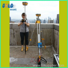
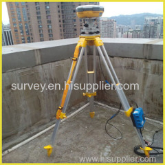
Main Applications of the V60 Geodetic Survey RTK GPS:
Construction stakeout
Rich point, line stakeout functions, combined with graphical user guidance to help you save more construction cost
Traffic Power
Convenient power direction finding, ranging, angle calculation function; comprehensive and practical road layout, the pile, pile edge measurement, vertical, cross-sectional measurements
CORS Application
CORS system for applications, just need one rover station can receive CORS RTK differential signal to do data collection, construction layout, etc.
CORS station
HD-CORS combines the advantages of HI-TARGET, such as mature technology, stable running, long distance transmission, etc., it is the solution of choice for a city to build a continuous reference station.
Control Survey
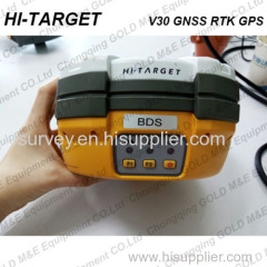
An investment, multiple functions, V30 GNSS RTK dual frequency static measurement accuracy meets the requirements of any control measure, supporting mature professional data solver software that can help you complete a variety of high-precision control measurements
Data collection
GIS-oriented system design hand book operating software, flexible encoding capabilities to meet your fast and efficient needs in data collection in the wild
Above Water Measurement
Work with HI-TARGET marine surveying, mapping software and echo sounder, easy to finish underwater topography measure, completely change the traditional mode of above water measurement and operation.
Underwater Construction Positioning
With HI-TARGET marine construction positioning software, V30 GNSS RTK system could help you accurately complete riprap, arrangement, piling and other marine engineering, to meet the special requirements for marine engineering construction projects.
Contact US:

Related Search
Find more related products in following catalogs on Hisupplier.com
Company Info
Chongqing Gold Mechanical & Electrical Equipment Company [China (Mainland)]
Business Type:Manufacturer, Trading Company, Agent
City: Chongqing
Province/State: Chongqing
Country/Region: China (Mainland)
You May Like:


Product (161)
- Underground resources detector (9)
- XRF Instrument (3)
- Drilling machine (4)
- Echo Sounder (21)
- total station (24)
- Borehole camera (2)
- level meters (9)
- Water level indicator (10)
- GPS (79)
